
STSE Water Cycle Multi-mission Observation Strategy – Irrigation
(WACMOS-Irrigation)
Background
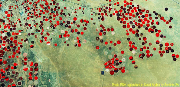
Irrigation is one of the greatest human intervention in the hydrological cycle. The knowledge of the distribution, the extent of irrigated areas and the amount of water used by irrigation is needed for different purposes: 1) modelling irrigation water requirements at the global scale, 2) assessing irrigated food production, 3) quantifying the impact of irrigation on climate, river discharge and groundwater depletion. Notwithstanding its recognized importance, to obtain high-quality information about the actual irrigated areas worldwide is nontrivial and the problem is much more pronounced in terms of the quantification of the water actually used for irrigation.
Scopo
WACMOS-Irrigation has the purpose to understand the potential of satellite soil moisture data in detecting and quantifying irrigation at global scale.
Metodi
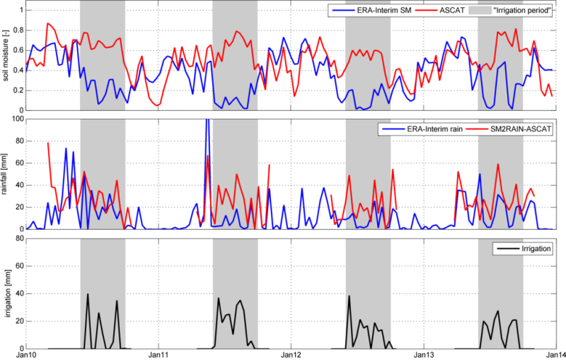
The satellite soil moisture data are used to quantify the amount of water exploited for irrigation. Specifically, satellite observations of soil moisture are used for mapping irrigated areas as already investigated in literature. The added-value of the project is addressed to the estimation of the water volume. This aspect is made possible thanks to the exploitation of SM2RAIN algorithm for the estimation of the rainfall through a bottom up approach.
Prodotti
Global scale irrigation datasets in terms of irrigation detection and water volume will represent the final products of the projects.
 Internal contact person: luca brocca -