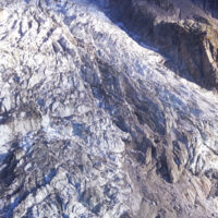
Climate change has a powerful impact on high-altitude Alpine sectors and glaciers. This impact often turns into an increase in instability processes that can lead to very high-risk conditions. These risk conditions can significantly affect the usability of areas characterized by intense tourist flows, making risk management very ...
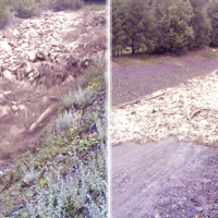
Not all that flows in creeks is water. Debris flows i.e., surges in which solid particles move together with little water, may occur in steep mountain streams, mainly as a consequence of intense rainfall. Debris flows have a high kinetic energy, and may cause major damage if they encroach buildings, roads and bridges. They are also a primary cause of landslide casualties. The video below shows an example of debris flows.
The low ...
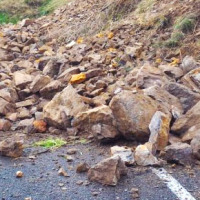
Among all types of landslide phenomena present in Alpine environment, the rockfalls are certainly the most impacting, because they also are extremely widespread. Rockfall are very difficult to monitor and they are often managed exclusively through the execution of active or passive works aimed at risk mitigation. Due to the rockfalls impulsive behavior, it is a difficult task to locate them a priori. The problem of rockfalls can be approached ...
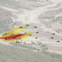
The 3DA software is a new procedure that allows retrieving in near-real-time 3D surface deformation models starting from data acquired via robotized total stations or others system that acquire the surface displacements. The measurements are first pre-processed and then implemented on 3D maps that include vector arrows representative of the intensities and of the real directions of motion in a given system of coordinates. The 3D surface ...
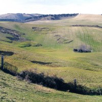
In Italy rainfall are among the main causes of trigger of shallow landslides, that yearly cause fatalities, damage, and severe economic losses. Identification of the amount of rainfall needed to trigger landslides, and the forecasting of rainfall-induced landslides, are of interest for the scientific community, as well as for the whole ...
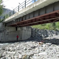
Monitoring of debris flows in instrumented areas is carried out since many years in different Countries worldwide. It is still missing, however, an adequate standardization of methodologies, instrumentations and procedures. The instrumented areas are also employed for testing warning systems. Even though these latter have been more and more employed, a systematic experimentation of these systems has not yet been carried ...
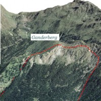
A Deep-seated Gravitational Slope Deformation (DGSD) affects the south-west flank of mount Ganderberg (Moso in Passiria – BZ). The continuous displacements of the landslide induce secondary hazardous phenomena. A 800.000 m3 rock slab shows signs of incipient movement; a detachment could create a natural barrier on the river ...
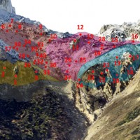
At the beginning of November 2010 exceptional rainfall events stroke the Veneto Region causing the re-activation of the Rotolon landslide which is a serious threat to the town of Recoaro Terme, Vicenza, ...
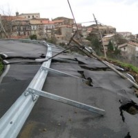
With reference to landslides, Italy is exposed to high-risk conditions (Guzzetti, 2000). The abundant and prolonged rains fallen in the 2008-2009 and 2009-2010 wet seasons triggered numerous landslides in Calabria, mostly in its northernmost sector. Such geo-hydrological crises were severe enough to induce the Italian government to declare the State of Emergency on both ...
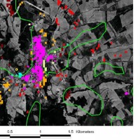
The focus on landslides results from the recognition that in many European countries slope instabilities affect urbanized areas and are a major threat to populations.
Through the integration of remotely sensed data with ground data we identify significant surface changes which are taking place on landslide susceptible slopes and this is used as input to the assessment of ...
 Climate change has a powerful impact on high-altitude Alpine sectors and glaciers. This impact often turns into an increase in instability processes that can lead to very high-risk conditions. These risk conditions can significantly affect the usability of areas characterized by intense tourist flows, making risk management very ...
  Not all that flows in creeks is water. Debris flows i.e., surges in which solid particles move together with little water, may occur in steep mountain streams, mainly as a consequence of intense rainfall. Debris flows have a high kinetic energy, and may cause major damage if they encroach buildings, roads and bridges. They are also a primary cause of landslide casualties. The video below shows an example of debris flows.
The low ...
  Among all types of landslide phenomena present in Alpine environment, the rockfalls are certainly the most impacting, because they also are extremely widespread. Rockfall are very difficult to monitor and they are often managed exclusively through the execution of active or passive works aimed at risk mitigation. Due to the rockfalls impulsive behavior, it is a difficult task to locate them a priori. The problem of rockfalls can be approached ...
  A Deep-seated Gravitational Slope Deformation (DGSD) affects the south-west flank of mount Ganderberg (Moso in Passiria – BZ). The continuous displacements of the landslide induce secondary hazardous phenomena. A 800.000 m3 rock slab shows signs of incipient movement; a detachment could create a natural barrier on the river ...


