156 projects found

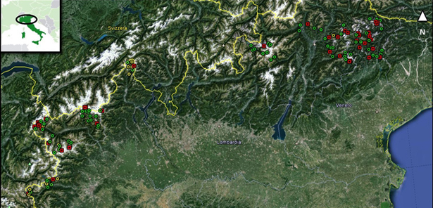
SAR change detection methodologies for event landslide mapping
Space agency From 30/01/2013 to 30/01/2015
Background The project explores and implements multi-scale and multi-sensor SAR change detection methodologies for event landslide mapping. Automated analysis for change detection is a challenging task due to the inherent…

Increasing Resilience through Earth Observation
European From 01/01/2013 to 31/12/2014
Background To significantly contribute to the operational capacities in the context of Global Monitoring for Environment and Security (GMES)/ Copernicus by developing customised mapping and geo-information products addressing risk, vulnerability…

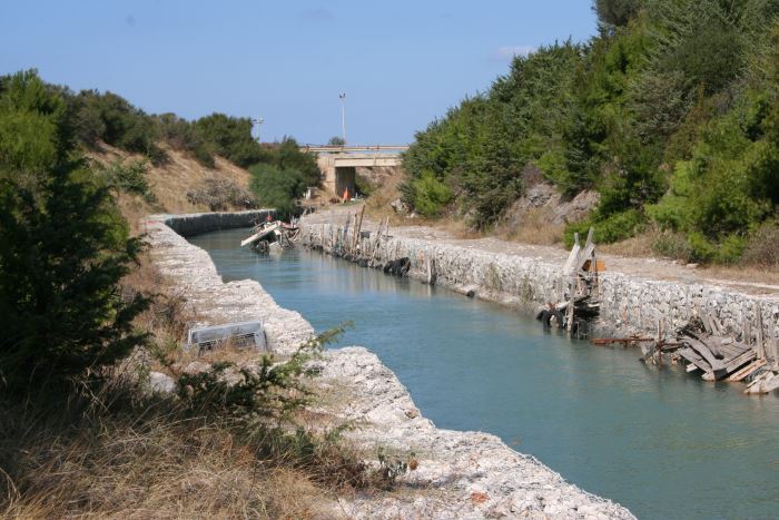
RIVERbank Surveillance bAsed on Fiber optic sEnsors
Local From 01/10/2012 to 30/09/2015
Background In the last decades Europe and Italy suffered many damaging floods, causing thousands of deaths, the displacement of millions of people and billions of euros in insured economic losses.…

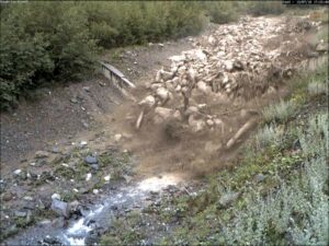
Analysis of the Mt. de La Saxe landslide
Regional From 01/10/2012 to 31/12/2023
Background The Mont de La Saxe landslide affects the south-western side of Mont de La Saxe near Courmayeur, Valle d’Aosta. This landslide at present can be considered one of the…

FLoods and fIre Risk assessment and managEment
European From 01/10/2012 to 30/09/2015
Background FLIRE is a demonstration project aiming to the development of an integrated Decision Support System (DSS) for both flash floods and forest fires risk assessment and management. The DSS…
Climate change on slope failures initiation in the Italian Alps
Institute From 01/09/2012
Background Climate change in the Greater Alpine Region is seriously affecting glacial and periglacial areas, with relevant consequences on slope stability. Cryosphere degradation, changes of the precipitation and temperature patterns…
Sediment management in Alpine basins
European From 01/09/2012 to 30/06/2015
Background The understanding of the changing equilibrium between sediment supply from upstream and sediment transport capability of a river is important for the success of integrated water resource management. In…

Monitoring system for the Hahnebaum test site
European From 01/09/2012 to 30/06/2015
Background A Deep-seated Gravitational Slope Deformation (DGSD) affects the south-west flank of mount Ganderberg (Moso in Passiria – BZ). The continuous displacements of the landslide induce secondary hazardous phenomena. A…
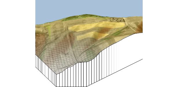
Spatially distributed modelling of landslide phenomena
Institute From 01/06/2012
Background The application of distributed physically based models is possible on relatively small areas, typically hundreds or few thousands of km2. Distributed modelling of slope dynamics requires many sufficiently detailed…

Zonazione della suscettibilità da frana si scorrimento in Umbria
Regional From 22/03/2012 to 21/03/2014
Background Realizzazione di modelli e carte di suscettibilità da frana tipo scorrimento per il territorio della Regione dell’Umbria. Purpose Il progetto ha come obiettivo la definizione e l’applicazione di metodi…
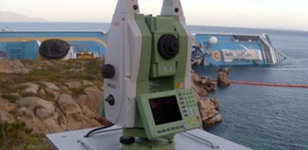
Topographic monitoring of the Costa Concordia vessel wreck
National From 20/01/2012 to 28/02/2014
Background Following the run aground off near the “Isola del Giglio” (Tuscany, Italy, January 13, 2012) of the cruise vessel “Costa Concordia”, a monitoring system for handling the security of…
Time-Space prediction of high impact landslides under changing precipitation regimes
From 14/01/2012 to 31/01/2016
Background In Italy a significant increase of landslide frequency and intensity in the last decades has been occurred, whose impact must be evaluated with respect to the convergence in possible…

Rainfall, seismicity, landslides and sediment discharge in mountain belts
Bilateral From 01/01/2012 to 31/12/2013
Background Taiwan, an active orogenic belt with subtropical climate is characterized by a high uplift rate and several major typhoons each year. Italy is on one of the most seismically…

Assessment of water Balances and Optimisation based Target setting across EU River Basins
European From 21/12/2011 to 21/03/2013
Background ABOT is one of the Pilot projects on Development of Prevention Activities to Halt Desertification in Europe, partly funded by DG Environment of the European Commission. The objective of…
Sinkholes in the Marina di Lesina area
Local From 01/05/2011 to 31/08/2011
Background Sinkholes are in Apulia among the main geohazards, and are at the origin of severe interactions with the anthropogenic environment, and heavy losses to society. Since several years the…