Filters
43 focus found

POLARIS: POpuLutAtion at RIsk of geo-hydrological events in Italy
Despite the large number and frequency of landslides and floods that affect our territories, and the information on landslides and floods available also online, the subject of geo-hydrological hazards remains...

Joint modeling of landslides and erosion processes
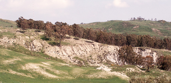
Different approaches have been proposed to model landslide and erosion processes separately. Only a few attempts have been made to model landslide and erosion jointly. Some models consider the effects...
Droughts, desertification and climate change in Calabria, Southern Italy
Using long-term rainfall records obtained by the rain gauge network of the former Italian Hydrographic Service, in cooperation with colleagues in other CNR Institutes (ISAC and ISAFOM), we have studied...

Overcoming together the traumas produced by natural disasters
A recent research has been carried out by Marco Pagani, researcher of the Institute of Cognitive sciences and technologies of the Italian National Research Council (Istc-Cnr) in Rome. The research...
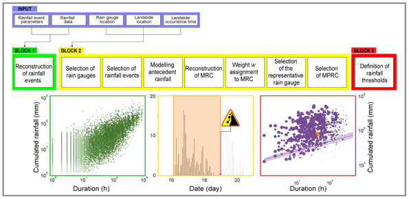
How to define rainfall thresholds automatically
The empirical rainfall thresholds while representing a useful approach used to forecast landslide occurrence in wide areas, are affected by several uncertainties related to the rainfall and the landslide information...

Preserving quality of scientific knowledge and information
It is part of the mission of the Italian National Research Council, and consequently of our Institute, the task of producing new knowledge. This aim, fundamental to the social and...

Landslide susceptibility models and maps
Landslide susceptibility is the likelihood of a landslide occurring in an area, given the local terrain conditions. It is the degree to which an area can be affected by future...

Migliorare l’attenzione del pubblico per una più efficace comunicazione del rischio
La sperimentazione ad ampio raggio condotta negli ultimi anni per testare sul campo la funzionalità e l’efficacia della procedura semplificata per la rielaborazione dei ricordi traumatici (RINOEL) ha consentito di evidenziare...
Automatic delineation of Slope Units
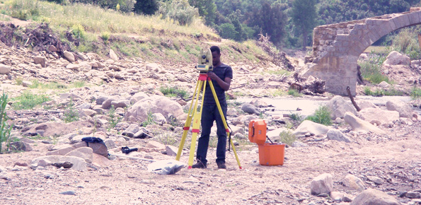
Quantitative geomorphological and environmental analysis requires the adoption of mapping units, well-defined spatial domains as basic mapping units which provide local boundaries to aggregate environmental and morphometric variables and to...
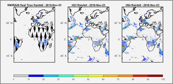
Rainfall estimate from space
We have developed a new satellite rainfall product in near real-time. The product, called H64, is based on the integration of rainfall estimates obtained through two satellite sources. The developed...

Optical Fibre Sensors for geo-hydrological and structural health monitoring applications
Optical fibres are generally aimed at large bandwidth transmission, and a few people know that the proposal of optical fibres as sensing elements is almost as old as their proposal...
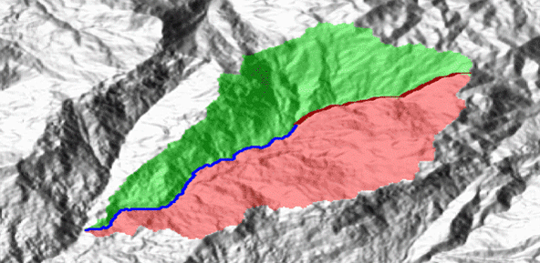
Documentation and analysis of flash floods
Flash floods occur in small to medium size river basins, and are characterised by fast temporal evolution. Because of their intensity and short warning times, flash floods often cause not...

We monitor the Planpincieux Glacier, along the Italian side of the Grandes Jorasses, Aosta Valley
Glaciers are typical of the Alpine landscape, and an important source of water. Undoubtedly fascinating, glaciers are very complex and yet surprisingly poorly known. In the Alps, many studies focus...