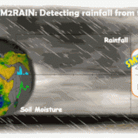
SM2RAIN is an innovative system for the estimation of the rainfall, based on measurements of the soil water content. SM2RAIN considers the soil as a natural rain gauge, and by measuring temporal variations of the soil water content, it estimates the rainfall falling on the soil, adopting a “bottom up” approach. Technically, SM2RAIN relies on the inversion of the soil water balance equation that computes the repartition of rainfall in ...
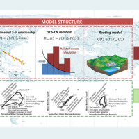
Water is at the centre of economic and social development; it is vital to maintain health, grow food, manage the environment, and create jobs. As well over half of the world’s potable water supply is extracted from rivers, either directly or from reservoirs, understanding the variability of the stored water on and below landmasses, i.e., total runoff, is of primary importance. In situ observations or land surface/hydrological models are ...
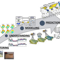
L'IRPI è da molti anni impegnato nel monitoraggio di variabili idrologiche (umidità del suolo, pioggia, portata e velocità dei corsi d'acqua) che è risultato fondamentale per la rappresentazione del processo di formazione del deflusso e quindi per lo studio delle piene e delle ...
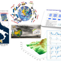
Rainfall-induced shallow landslides and floods are the most common and dangerous natural hazards, mainly due to their high temporal frequency, which causes fatalities and high economic damage worldwide. Climate changes will exacerbate this critical framework since an increase in extreme weather events is ...
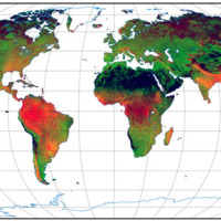
Accurate rainfall estimates are of paramount importance as rainfall plays a key-role in many fields as, to cite a few, natural hazard assessment (floods and landslides), drought management, weather forecasting, agriculture and diseases prevention. State-of-the-art rainfall products obtained by satellites are often the only way for measuring rainfall in remote areas of the ...
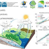
Monitoring the water cycle from satellite observations is one of the major goals of the EO community and closing the water budget has been a long-standing objective of international programs. After years of hard work, calibrating satellite data, improving inversion techniques, and facilitating the coherency of retrievals, it is admitted that the water cycle budget can now be ...
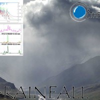
Quantitative information about precipitation is one vital input to meteorologists, hydrologic scientists, water resources managers, and environmental legislators. Yet, accurate measurement of precipitation over the relevant space and time scales remains a challenge. Soil moisture can be seen as the trace of the precipitation and, consequently, can be useful for providing a way to estimate rainfall accumulation or at least a new constrain to ...
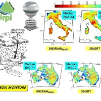
State-of-the-art satellite rainfall products are often the only way for measuring rainfall in remote areas of the world. However, these products may fail in properly reproducing the amount of precipitation reaching the ground, which is needed for hydrological applications. The integration of satellite soil moisture products is expected to significantly improve rainfall ...
Recently, IRPI-CNR has developed an innovative approach for estimating rainfall from satellite soil moisture data, named SM2RAIN. The ESA funded project “Climate Change Initiative - Soil Moisture“ (CCI-SM) offers a valuable opportunity for testing SM2RAIN algorithm to a continuous, homogenous, long-term (>30 years) soil moisture time series. Indeed, SM2RAIN has the chance to be tested not only for rainfall estimation but also as a ...
The project aims at using Soil Moisture Active and Passive (SMAP) soil moisture (SM) products at different spatial resolution (3, 9, and 36 km) for hydrological applications in Europe (mainly in ...
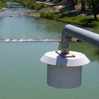
The hydro-meteorological monitoring is the operational tool for the measures of atmospheric, hydrologic ad hydraulic variables characterizing the hydrological cycle and it represents the grounds of IRPI’s research activities finalized to forecast, prevention and mitigation of natural hazards. Indeed, an accurate knowledge of processes at basis of natural phenomenon cannot disregard the direct measure of hydrological quantities, considering ...
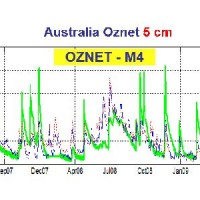
The service aims to assess the potential of different satellite products (from active and passive micro-waves, optical, SAR, spectroradiometers, radiometers sensors) in retrieving the main hydrological-hydraulic variables such as rainfall, soil moisture, water level, flow velocity and discharge. This is pursued through a comprehensive validation analysis by using in-situ observed or modelled data for several sited located ...
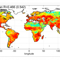
The rainfall dataset provides rainfall estimates obtained through the application of an inversion algorithm to soil moisture data. The algorithm has been applied to ground and satellite data, obtained through various satellite ...
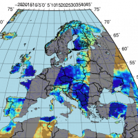
The H-SAF generates and archives high-quality data sets and products for operational hydrological applications starting from the acquisition and processing of data from Earth observation satellites in geostationary and polar orbits operated both by EUMETSAT and other satellite organization. The retrieval of products uses data from microwave and infrared instruments and aims at reaching the best possible accuracy compatible with satellite ...
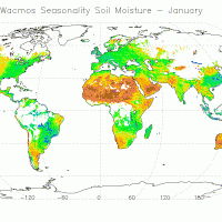
The CCI Programme wants to contribute to the data bases collecting ECVs required by GCOS (Global Climate Observing System) and other international parties. In particular, the Soil Moisture CCI will analyse the needs of the climate research community in terms of soil moisture data, adapt soil moisture satellite measurements for their use by the climate research community and create a long-term consistent soil moisture time series, based on ...
 SM2RAIN is an innovative system for the estimation of the rainfall, based on measurements of the soil water content. SM2RAIN considers the soil as a natural rain gauge, and by measuring temporal variations of the soil water content, it estimates the rainfall falling on the soil, adopting a “bottom up” approach. Technically, SM2RAIN relies on the inversion of the soil water balance equation that computes the repartition of rainfall in ...
  Water is at the centre of economic and social development; it is vital to maintain health, grow food, manage the environment, and create jobs. As well over half of the world’s potable water supply is extracted from rivers, either directly or from reservoirs, understanding the variability of the stored water on and below landmasses, i.e., total runoff, is of primary importance. In situ observations or land surface/hydrological models are ...
  Accurate rainfall estimates are of paramount importance as rainfall plays a key-role in many fields as, to cite a few, natural hazard assessment (floods and landslides), drought management, weather forecasting, agriculture and diseases prevention. State-of-the-art rainfall products obtained by satellites are often the only way for measuring rainfall in remote areas of the ...
  Monitoring the water cycle from satellite observations is one of the major goals of the EO community and closing the water budget has been a long-standing objective of international programs. After years of hard work, calibrating satellite data, improving inversion techniques, and facilitating the coherency of retrievals, it is admitted that the water cycle budget can now be ...
  Quantitative information about precipitation is one vital input to meteorologists, hydrologic scientists, water resources managers, and environmental legislators. Yet, accurate measurement of precipitation over the relevant space and time scales remains a challenge. Soil moisture can be seen as the trace of the precipitation and, consequently, can be useful for providing a way to estimate rainfall accumulation or at least a new constrain to ...
  State-of-the-art satellite rainfall products are often the only way for measuring rainfall in remote areas of the world. However, these products may fail in properly reproducing the amount of precipitation reaching the ground, which is needed for hydrological applications. The integration of satellite soil moisture products is expected to significantly improve rainfall ...
  Recently, IRPI-CNR has developed an innovative approach for estimating rainfall from satellite soil moisture data, named SM2RAIN. The ESA funded project “Climate Change Initiative - Soil Moisture“ (CCI-SM) offers a valuable opportunity for testing SM2RAIN algorithm to a continuous, homogenous, long-term (>30 years) soil moisture time series. Indeed, SM2RAIN has the chance to be tested not only for rainfall estimation but also as a ...
  The hydro-meteorological monitoring is the operational tool for the measures of atmospheric, hydrologic ad hydraulic variables characterizing the hydrological cycle and it represents the grounds of IRPI’s research activities finalized to forecast, prevention and mitigation of natural hazards. Indeed, an accurate knowledge of processes at basis of natural phenomenon cannot disregard the direct measure of hydrological quantities, considering ...
  The service aims to assess the potential of different satellite products (from active and passive micro-waves, optical, SAR, spectroradiometers, radiometers sensors) in retrieving the main hydrological-hydraulic variables such as rainfall, soil moisture, water level, flow velocity and discharge. This is pursued through a comprehensive validation analysis by using in-situ observed or modelled data for several sited located ...
  The H-SAF generates and archives high-quality data sets and products for operational hydrological applications starting from the acquisition and processing of data from Earth observation satellites in geostationary and polar orbits operated both by EUMETSAT and other satellite organization. The retrieval of products uses data from microwave and infrared instruments and aims at reaching the best possible accuracy compatible with satellite ...
  The CCI Programme wants to contribute to the data bases collecting ECVs required by GCOS (Global Climate Observing System) and other international parties. In particular, the Soil Moisture CCI will analyse the needs of the climate research community in terms of soil moisture data, adapt soil moisture satellite measurements for their use by the climate research community and create a long-term consistent soil moisture time series, based on ...


