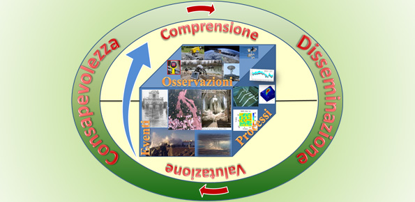
153 projects found
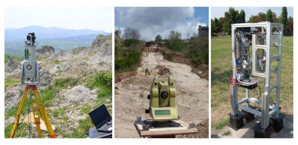
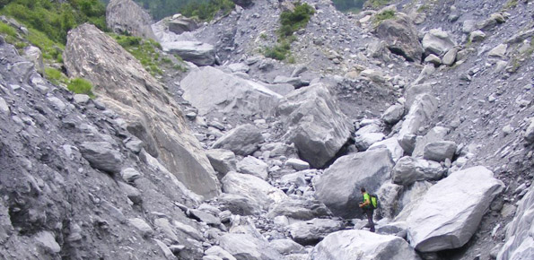
Landslide monitoring Innovative methods and instruments
Regional From 09/05/2017 to 30/11/2018
Background The development of new systems for monitoring of landslides is often the synthesis of geomatics and applied geology. In particular, the development of innovative low-cost systems must have a…
Regenarating ECOsystems with Nature-based solutions for hydro-meteorological risk rEduCTion
European From 01/09/2018 to 31/08/2023
Background RECONECT is a Horizon 2020 project that aims to enhance the European reference framework on Nature Based Solutions (NBS) for hydro-meteorological risk reduction by demonstrating, referencing, upscaling and exploiting…
Towards geohazards resilient infrastructure under changing climates
European From 01/01/2018 to 31/12/2022
Background A trend of increasingly frequent intense rainfalls and changing rainfall patterns is causing a relevant number of landslides and floods affecting urban areas and engineering infrastructures such as roads,…
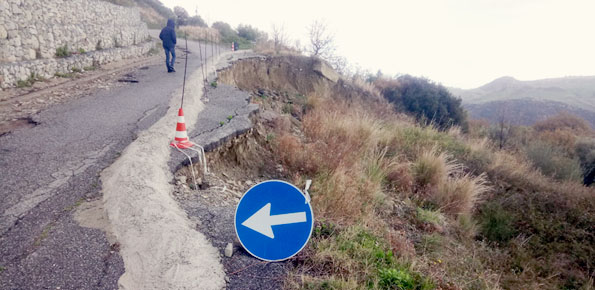
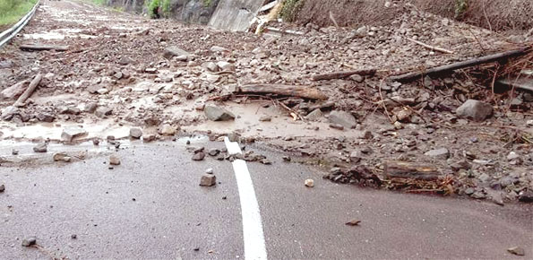
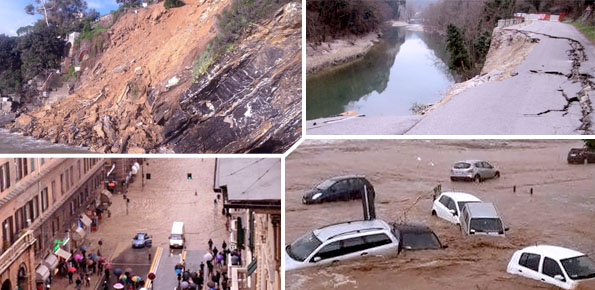
Decree 473: early civil protection actions to cope with rainfall events that affected Calabria on November 2016 and January 2017
Regional From 09/03/2018 to 09/03/2020
Background During about two months, two rain events that occurred in the periods 25-26 November 2016 and 22-25 January 2017 affected Calabria region, producing landslides and floods and causing huge…
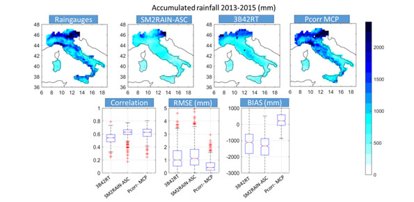
SMOS+RAINFALL II
Space agency From 29/03/2018 to 29/03/2019
Background Quantitative information about precipitation is one vital input to meteorologists, hydrologic scientists, water resources managers, and environmental legislators. The past SMOS+Rainfall project addressed the improvement on a global scale…
Progetto PON Governance
National From 25/09/2017 to 25/12/2021
Purpose Il progetto prevede un’attività di servizio e di supporto tecnico scientifico per la realizzazione di progetti standard che affrontano i temi della pianificazione comunale di protezione civile e degli…
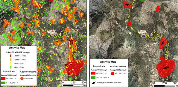
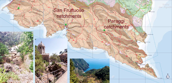
Geohazard impact assessment for urban areas
European From 01/01/2018 to 31/12/2019
Purpose The project is focused on monitoring geohazard-associated ground deformations, a key prevention action specifically addressed to urban areas and critical infrastructures. The project will propose a procedure to produce…

Smart Monitoring of basins subject to high geohydrological risk
Regional From 01/12/2017 to 30/11/2019
Background The R&D project SMoRI starts from two needs to be reconciled. The first, coming from the scientific community, concerns a best definition of integrated monitoring systems aimed at controlling…
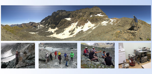
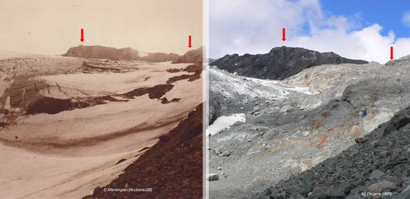
RiST2, the research go on
Local From 08/01/2018 to 15/06/2020
Background The researches at high-elevation sites continues, thanks to the RiST2 project (co-financed by Fondazione CRT of Torino). The study area is the Bessanese glacial basin. The Alpine environment and…
Mediterranean Services Chain Based On Climate Predictions
European From 15/09/2017 to 14/09/2020
Background The project focuses on climate predictions from seasonal-to-decadal timescales for the Mediterranean region (here defined as the domain encompassing the Mediterranean basin and the surrounding areas), and their applications…
Integrated approach for the development across Europe of user oriented climate indicators for GFCS high-priority sectors: agriculture, disaster risk reduction, energy, health, water and tourism
European From 15/09/2017 to 15/09/2020
Background Climate change strongly impacts the whole European territory. Drought severely affects agriculture; precipitation extremes are associated with flooding, severe damage to properties and lives; temperature extremes can increase mortality;…
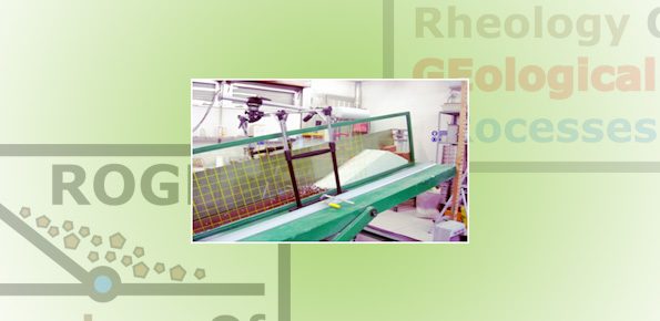
Rheology of geological processes
Institute From 01/01/2015 to 31/12/2020
Background Critical and depositional friction angles are characteristic for the deposition of a granular mass; the wrong angle adoption determines the ineffectiveness of a containment basin. The term is used…
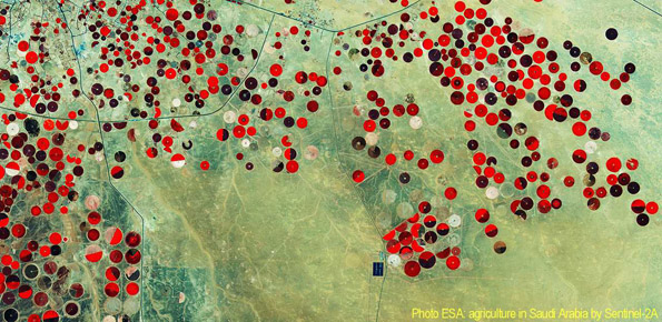
STSE Water Cycle Multi-mission Observation Strategy – Irrigation
Space agency From 01/02/2017 to 01/02/2018
Background Irrigation is one of the greatest human intervention in the hydrological cycle. The knowledge of the distribution, the extent of irrigated areas and the amount of water used by…
Accuracy of hydrological data for extreme events analysis and upgrade of Umbria Regional Hydrological Service’s platform
Regional From 01/01/2017 to 30/06/2017
Background The improved understanding of the underlying physical processes of extreme events is closely linked to the development and verification of procedures to better control, analysis and validation of hydrological…
Cooperative Internet-of-Data Rural/Alpine Community Environment
Regional From 03/11/2014 to 31/12/2019
Background Environmental sensor monitoring is continuously developing, both in terms of quantity (i.e. measurement sites), and quality (i.e. technological innovation). Environmental monitoring is carried out by either public or private…