156 projects found
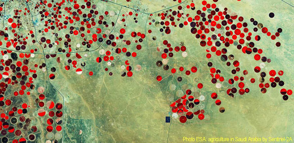
STSE Water Cycle Multi-mission Observation Strategy – Irrigation
Space agency From 01/02/2017 to 01/02/2018
Background Irrigation is one of the greatest human intervention in the hydrological cycle. The knowledge of the distribution, the extent of irrigated areas and the amount of water used by…
Accuracy of hydrological data for extreme events analysis and upgrade of Umbria Regional Hydrological Service’s platform
Regional From 01/01/2017 to 30/06/2017
Background The improved understanding of the underlying physical processes of extreme events is closely linked to the development and verification of procedures to better control, analysis and validation of hydrological…
Cooperative Internet-of-Data Rural/Alpine Community Environment
Regional From 03/11/2014 to 31/12/2019
Background Environmental sensor monitoring is continuously developing, both in terms of quantity (i.e. measurement sites), and quality (i.e. technological innovation). Environmental monitoring is carried out by either public or private…

Strategies, Tools and new data for REsilient Smart Societies
Foundations From 10/05/2017 to 10/05/2019
Background The STRESS project is intended to design, implement and test a prototype of a Spatial Information Infrastructure (SII) enabling the provision to spatial planners and risk managers of new…
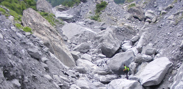
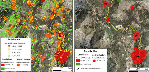
Deep seated Gravitational Slope Deformation (DsGSD) analysis and criticalities assessment of the regional monitoring network of the landslides
Regional From 15/07/2015 to 20/12/2016
Background The Aosta Valley region presents a landscape almost totally occupied by mountain. In this context, a number of meaningful landslides is present, which vary from rock falls to deep-seated…
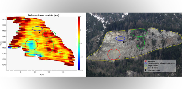
Monitoring of the Gollone landslide, Acceglio (CN)
Regional From 01/09/2015 to 31/10/2017
Background The landslide monitoring represents a strategic activity, especially for those phenomena for which it is not possible (for technical or financial reasons) to realize stabilization interventions of the landslide.…

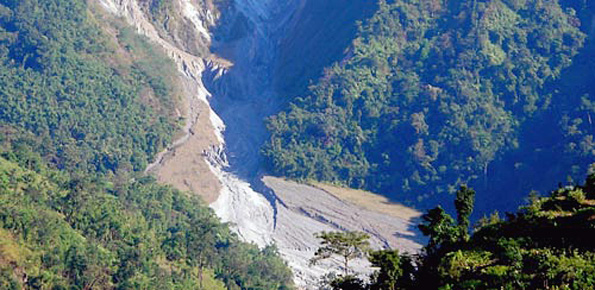
Sino-Italian Joint Laboratory on Geological and Hydrological Hazards
International From 01/01/2017 to 31/12/2019
Background Both China and Italy are characterized by large mountainous areas, where natural hazards (e.g., geological and hydrological hazards such as debris flows, landsides, flash floods) are widespread and seriously…
Landslide Multi-Hazard Risk Assessment, Preparedness and Early Warning in South Asia Integrating Meteorology, Landscape and Society
International From 01/11/2016 to 31/10/2020
Background In India, as in many other areas in Asia and in the world, landslides are abundant and frequent, and they represent a serious hazard to the local population. The…

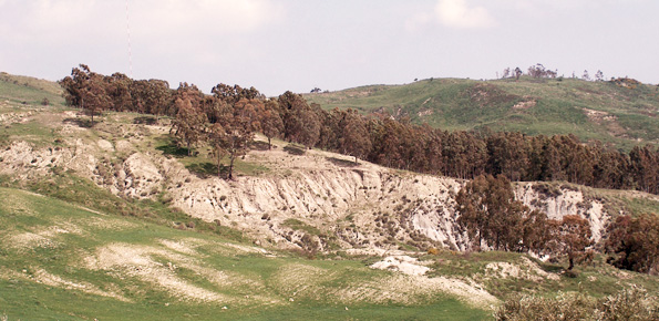
Hazard of alluvial fans
Regional From 01/07/2009 to 31/07/2010
Background In international literature, it is now widely recognized that alluvial fans are areas of high geomorphic activity. Debris flows and flash floods occur episodically in these environments, and place…
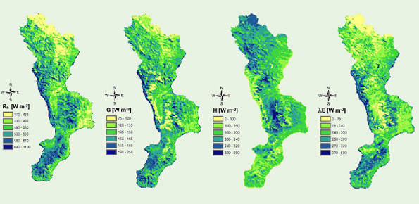
Identification and estimation of the parameters for assessing the risk of desertification
National From 01/05/2004 to 30/09/2007
Background The Calabria region, because of its climatic, geomorphological and anthropic characteristics, is one of the regions most exposed to the risk of desertification in the Mediterranean basin. Methods already…
Methodology for the estimation of environmental risk indicators, using satellite remote sensing techniques
Regional From 01/06/2008 to 31/01/2009
Background EPSILON Italia, the leader of the partnership proposing the project, is a SME, located in Calabria, specializing in the delivery of advanced services for the protection and management of…
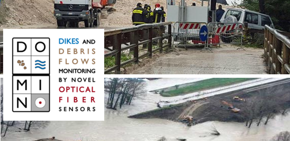
Dikes and Debris Flows Monitoring by Novel Optical Fiber Sensors
European From 01/05/2016 to 30/04/2019
Background With more than 5 million people affected, more than 1000 killed, and with estimated total damages exceeding 4.5 billion Euros just in Europe and during the last decade, floods…
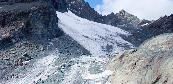
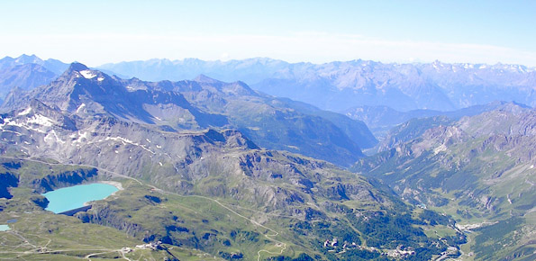
RiST project: Scientific and Technological research in the Bessanese glacial basin (Balme, NW Italian Alps)
Local From 08/01/2016 to 08/01/2018
Background The Alpine environment, and in particular the high-altitude one, is responding quickly and with great intensity to climate change, through evidences of geomorphological, hydrological and ecological type. Mountain glacier…
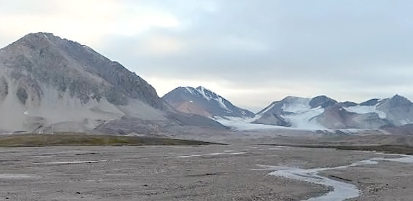
SLOPES
International From 01/03/2016 to 30/06/2017
Background This project is embedded within the framework of the three Ny-Ålesund flagships: ‘Kongsfjorden system’, ‘Glaciology’ and ‘Terrestrial system’. The study of slopes and landscape modifications under a changing climate,…
Sentinel for Geohazards regional monitoring and forecasting
European From 01/01/2016 to 31/12/2017
Purpose SAFETY aims at providing Civil Protection Authorities with the capability of periodically evaluating and assessing the potential impact of geohazards (volcanic activity, landslides and subsidence) on urban areas. The…