69 contracts found
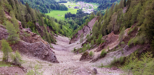
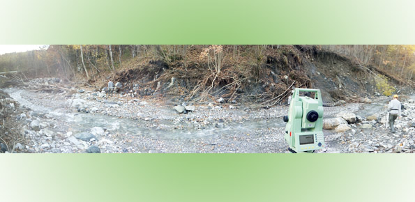
Geological investigations in the catchment of the Rio Kortol
From 13/12/2017 to 12/12/2018
Background Past debris flows in the Rio Kortol catchment arise concerns for the safety of the village of Sauris di Sotto, and urge new studies for the assessment of hazard…
Characterization, modelling and monitoring
From 01/01/2016 to 31/12/2021
Background The project concerns the mitigation of natural hazards (mainly the effects on the territory and the anthropic environment caused by rains, earthquakes, volcanism, and Radon gas). The geological characterization…
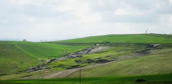
Integrated assessment of geo-hydrological instability phenomena in the Apulia region, interpretative models and definition of rainfall thresholds for landslide triggering
From 15/12/2016 to 09/12/2020
Background The Apulia region is affected by multiple types of geo-hydrological instability processes such as sinkholes, flash floods and landslides. Landsliding mainly affects the north-western sector of the Region (bordering…
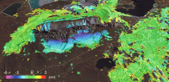
Radar remote sensing techniques for the detection and measurements of ground surface deformations
From 01/01/2017 to 31/12/2019
Background Space-borne radar interferometry or DInSAR (Differential Interferometric Synthetic Aperture Radar) is one of the latest techniques used for the detection and measurement of ground surface deformations caused by natural…
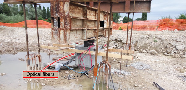
Research and development of optical fiber sensors for geotechnical and environmental monitoring
From 01/01/2017 to 31/12/2019
Background Application of optical fibers is generally aimed at large bandwidth transmission. Few people know that the proposal of optical fibers as sensing elements is almost as old as their…
Landslides investigation and mitigation at Passo della Morte (UD)
From 26/06/2015 to 26/06/2018
Background L’area del “Passo della Morte” (UD) è interessata da una situazione di grave dissesto a causa della presenza di più movimenti franosi. Questi sono caratterizzati da elevata pericolosità in…
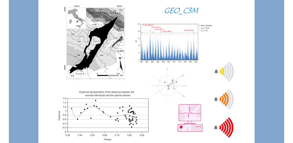
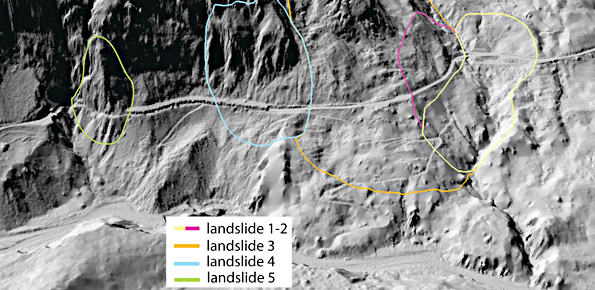
Large landslides: Monitoring, Modelling and Mitigation
From 01/01/2017 to 31/12/2019
Background The study of the dynamics of large landslide is a heuristic process based on the integration of multiple investigation techniques: geological and geomorphological analysis, monitoring systems (traditional and innovative)…
Qualitative and quantitative degradation risks of water resources and effects on human activities
From 01/01/2016 to 31/12/2018
Background The research topics involve the consideration of geological, geomorphological, hydrological, hydrogeological, and technology and the use of innovative methodologies to achieve the sustainability of the natural balance inherent inland…
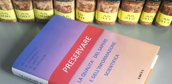
Preserving the quality of the scientific information
From 01/01/2017 to 31/12/2019
Background Producing knowledge implies the responsibility to divulge it with quality, making it available for everyone. With the advent of the Internet the possibilities to retransmit knowledge have grown, but…
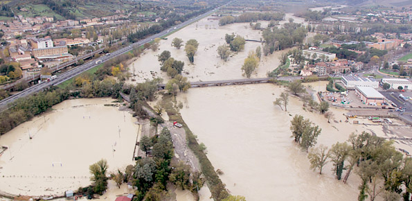
Flood forecasting and hydraulic risk
From 01/01/2016 to 31/12/2020
Background The project is focused on flood forecasting and hydraulic risk, i.e. the assessment of the effects of flooding in flood-prone areas also involving the vulnerability assessment of the hydraulic…
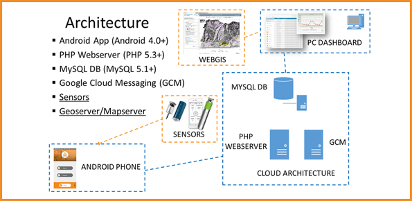
E-TECH New technologies for support and prevention of emergencies
From 01/01/2017 to 31/12/2017
Background The management of natural hazards tends radically to distribute responsibilities at the local level, as the first civil protection actors. Prevention and preparedness are long-term goals, rooted in volunteer…
Kinematic of debris flows using Large Scale Particle Image Velocimetry (LSPIV)
From 06/02/2015 to 15/01/2016
Background Usually the video cameras installed within a debris-flow monitoring site have the role of recording videos to better understand the behavior of the event for an improved interpretation of…
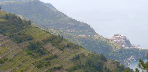
Geomorphometry and sediment dynamics in mountain catchments
From 01/01/2016 to 31/12/2021
Background The aim of the geomorphometric analysis is to derive indices capable of characterizing the spatial variability of specific hydro-geomorphological processes (e.g., sediment connectivity, erosion and deposit). The growing availability…
Safe Landscapes: prevention and adaptation strategies
From 08/01/2017 to 08/07/2018
Background The project aims at defining the type of expected natural hazards, the modeling approaches relevant for their evaluation, and possible monitoring tools in specific areas prone to landslide risk…
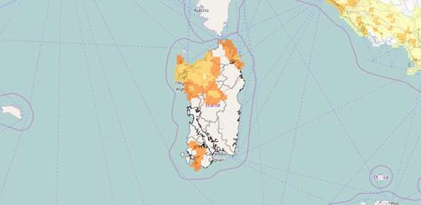
Agreement with the Autonomous Region of Sardinia
From 27/12/2016 to 26/12/2018
Background In Italy, landslides are triggered by intense and/or prolonged rainfall. The spatial and temporal forecast of multiple landslides triggered by rainfall in wide areas relies primarily on empirical rainfall…