Civil Protection authorities use ELIMs in the aftermath of an event for improved rescue and recovery operation.
Planning & development authorities use ELIMs to identify areas recently affected by landslides, and avoid dangerous areas.
Transportation authorities & utility managers use ELIMs to evaluate the impact of landslides on transportation or utility network.
Agricultural & forest agencies use ELIMs to assess the impact of landslides on crops and forests.
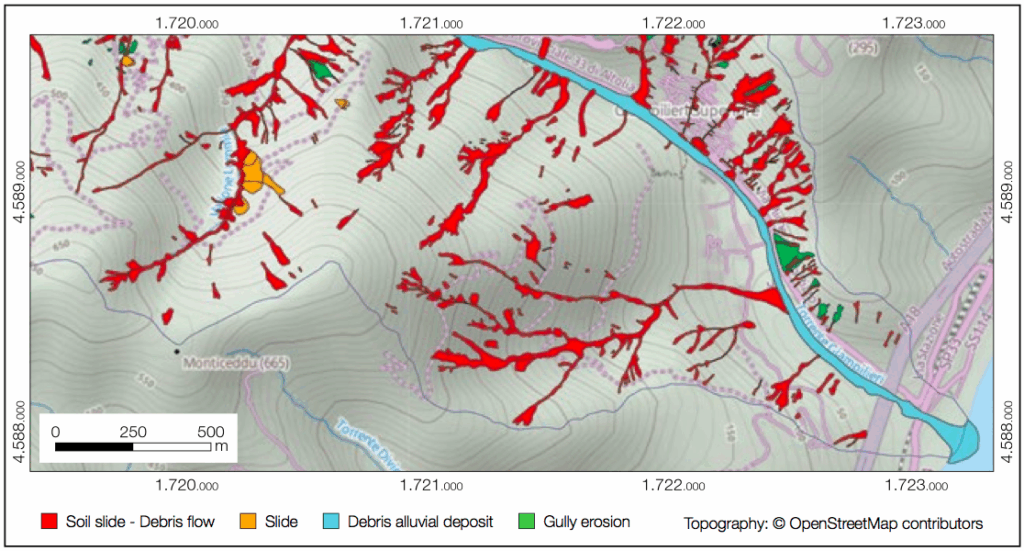
Scientists use ELIMs to prepare multi-temporal inventories useful for erosional studies, and to determine the statistics of landslide areas.