Aerial LiDAR for research activities
Focus
Report on 7 years of activities

Internal contact person: Marco Baldo
Email: marco.baldo@cnr.it

The LiDAR sensor available to the institute has recently turned seven years since the first survey executed on November 2, 2011, in the aftermath of the flood event that affected large areas of the Liguria Region, northern Italy.
The system consists of a laser head RIEGL LMS-Q680i, a medium format camera Hasselblad H3DII-39Mpixel f=50mm, an IMU IGI 256Khz, and a GNSS system Novatel-OEM4, and has since operated on many Italian areas thanks to its configuration with external POD DART that allows its installation on the most widespread type of helicopter in Italy, the Eurocopter AS350-355 (single engine)/355 (twin engine) Version B1/B2/B3/B3 Plus.
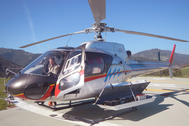
Fig. 1: LiDAR external POD (DART) installed on EUROCOPTER AS350 B3.
To minimize the costs of moving the sensor towards the areas of investigation, the instrumentation is moved by land to the nearest air base with a specially equipped trolley.
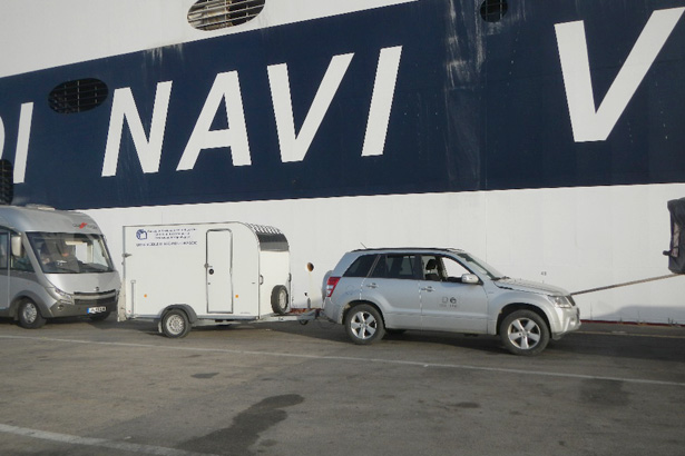
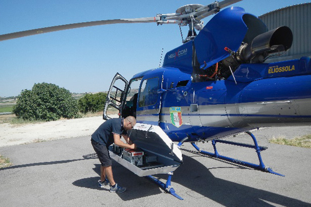
Fig. 2,3: Sea boarding of the carrier and sensor installation over Eliossola AS350 B3 in Caltanisetta, Sicily, southern Italy.
The equipment is then installed and uninstalled by technicians of the Institute under the supervision of the staff of the company that owns the aircraft, which, at the end of the operations, issues an EASA FORM1 bulletin certifying that the instrumentation was installed or uninstalled according to the specifications prescribed for the system. The installation, standardized by type of aircraft, involves the wiring of the sensors inside the cockpit of the helicopter, and the installation of three monitors for management and navigation and the positioning of the GNSS antenna on the tail plane.
Donwload attachmentFurther details
See the news “The aerial LiDAR of CNR IRPI is now EASA MINOR approved” »