Background
The urbanisation of seismically active areas, coupled with the ongoing change in climate patterns, require a shift in the approaches to land/infrastructure instability hazard assessment and risk reduction. This is particularly relevant in seismically active regions where the recurrent damage from landsliding, subsidence and ground deformations can be widespread. Geotechnical investigations and in situ monitoring of land prone to instability are necessarily limited in terms of spatial and temporal coverage and need to be complemented by remote sensing and geophysical surveying.
Purpose
The project aims to promote the employment of complementary, cost-effective approaches (“preventive monitoring” via satellite remote sensing, reconnaissance geophysical surveying) and the integration of space- and ground-based geotechnical information for early detection and assessment of potential land and infrastructure instability hazards in seismically active areas.
Methods
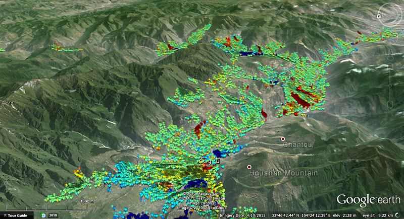
Advanced multi-temporal interferometry techniques using high resolution satellite radar imagery
Long-term accelerometer monitoring (local networks) and the exploitation of low-cost reconnaissance techniques based on the analysis of ambient noise recorded by portable seismic instruments (tromographs)
Geo-hydro-mechanical monitoring of unstable slopes in Southern Italy, for improved long-term landslide/ground instability hazard assessment and provision of ground truth to be integrated with space-derived information