69 contracts found

Accordo di collaborazione scientifica tra l’Universita’ della Calabria e il Consiglio Nazionale delle Ricerche per il rilevamento geomorfologico e del quaternario del foglio geologico in scala1:50.000 n. 575-Catanzaro e dell’area della piana di Lamezia (progetto CARG) CUP H23C22001040007
Agreement From 09/06/2025 to 31/12/2026
Fiber optic sensors engineering for the monitoring of structural reinforcements on unstable slopes
From 03/08/2019 to 19/04/2021
Background Geo-Hydrological risks are one of the main sources of economic losses for our country causing a huge number of victims and damages. From 1966 to 2015, landslides and floods…

ITALGAS service
From 07/03/2016 to 07/03/2020
Background ITALGAS requires a certification attesting the conformity of the backfill material used for its distribution network Purpose The activities include the implementation of particle size analysis on samples of…
Typify geo-hydrological events
From 01/01/2016 to 31/12/2019
Background A Geo-hydrological event (EDId) (landslides, mass movements, floods, etc.) can result in a high social and economic impact, especially if it is generated by multiple simultaneous phenomena, when it…
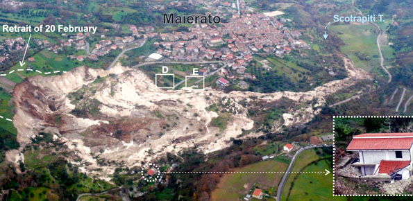
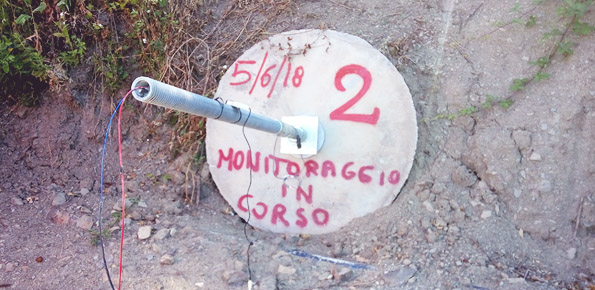
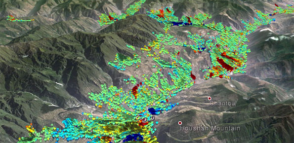
Monitoring and landslides risk in the Maierato area
From 11/01/2017 to 10/01/2019
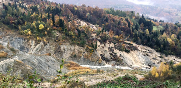
Background The Maierato landslide (Vibo Valentia Province) is a complex movement, which involved a significant thickness of geomaterials (rocks and soils) and rapidly flowed away for one kilometre. Owing that,…
Studio e monitoraggio dei processi idrologici
From 01/01/2016 to 31/12/2020
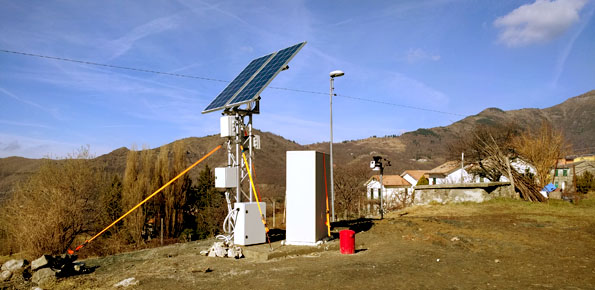
Background L’IRPI è da molti anni impegnato nel monitoraggio di variabili idrologiche (umidità del suolo, pioggia, portata e velocità dei corsi d’acqua) che è risultato fondamentale per la rappresentazione del…
Preventive evaluation of land instability hazards
From 01/01/2016 to 31/12/2020
Background The urbanisation of seismically active areas, coupled with the ongoing change in climate patterns, require a shift in the approaches to land/infrastructure instability hazard assessment and risk reduction. This…
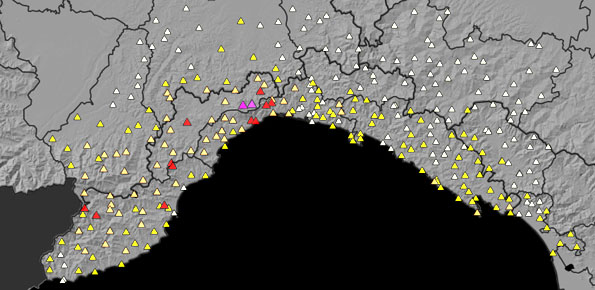
Agreement with the Ligurian Regional Agency for Environmental Protection (ARPAL)
From 12/10/2017 to 30/06/2019
Background Since 2013, CNR IRPI went in with the collection of information on rainfall events that have resulted in landslides in the Liguria region. Rainfall thresholds can be used in…
Sentinels for the Territory
From 01/01/2018 to 31/12/2018
Background The knowledge of the geo-hydrological hazard of a territory and of the risk conditions for people, are essential for the implementation of civil protection activities. The monitoring activity by…
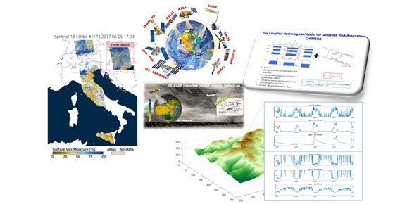
Hydrological monitoring and prediction of shallow landslides through remote sensing observations
Background Rainfall-induced shallow landslides and floods are the most common and dangerous natural hazards, mainly due to their high temporal frequency, which causes fatalities and high economic damage worldwide. Climate…
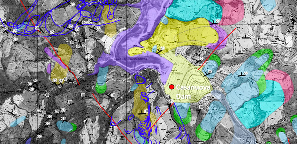
Cartografia delle frane nell’area dell’invaso di Casanuova (PG)
From 17/07/2018 to 17/10/2019
Background The reservoir of Casanuova on the Chiascio river, Central Umbria, occupies an area affected by numerous landslides, already identified in the regional cartographies. However, the potential interaction between the…
Tessina and Lamosano Landslides Monitoring
From 01/01/2016 to 06/12/2022
Background The Tessina Landslide has been, almost continuously, monitored by IRPI, Padova Unit, since its main reactivation in April 1992. Therefore the Veneto Region entrusted IRPI with the continuation of…
Study and monitoring activities on Arzeno landslide – Municipality of Ne (GE)
From 01/09/2018 to 31/03/2019
Background The Municipality of Ne (GE) is involved by an important landslide in the Arzeno and Prato di Reppia areas. The phenomenon is monitored using standard techniques for some years.…
Hydrogeological study for the risk analysis of a landfill.
From 23/05/2014 to 23/07/2018
Background The company “Progetto Gestione Bacino Bari Cinque srl” has entrusted at the Research Institute for Geo-Hydrological Protection of the CNR the “Hydrogeological study for the risk analysis of the…
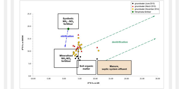
Partenariato di studio e documentazione a supporto dell’attività legislativa sugli Obiettivi di Sviluppo Sostenibile e focus sul geoscambio termico
From 01/11/2018 to 31/10/2020
Background The topic of low geothermal enthalpy is crucial as a strategy to mitigate and adapt to climate change. With this in mind, the structuring of environmental knowledge and information…