Historical landslides and floods in Calabria
We study historical landslide and flood events in Calabria, and their impact from the nineteenth century until today.
Focus

Internal contact person: Olga Petrucci
Email: olga.petrucci@cnr.it

Landslides and floods tend to hit places that by their nature and geographic location are more likely than others to be damaged. Knowing the location of these places, and how they have been affected in the past by landslides and floods, allows to draw damage scenarios for possible future events.
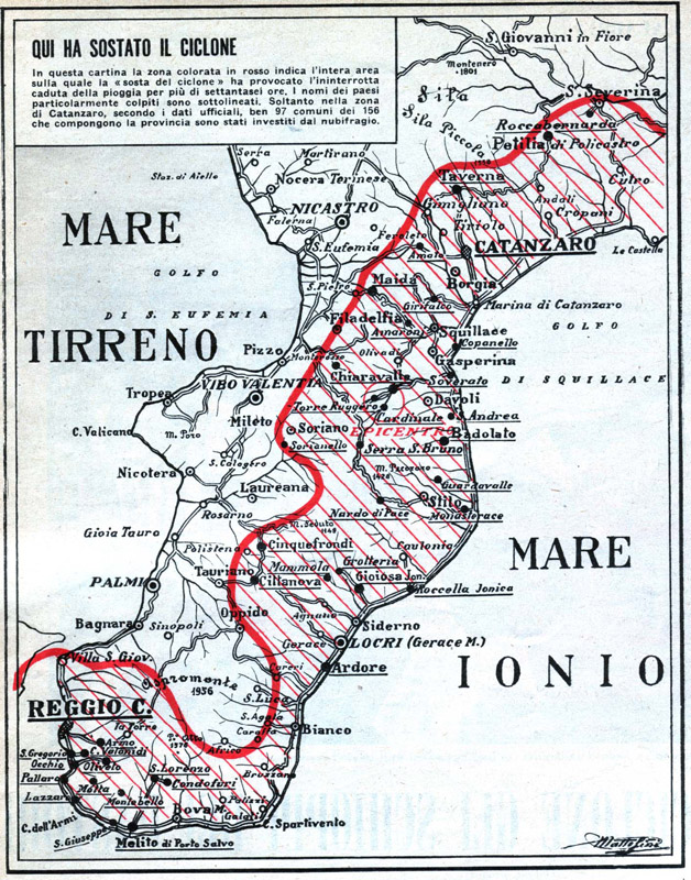
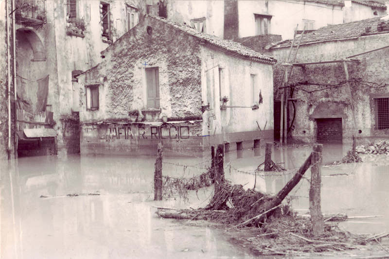
For years, we have studied historical landslide and flood events in Calabria. Our investigations have allowed us to reconstruct a unique historical record of particularly significant events that have affected Calabria in the period from the nineteenth century to today.
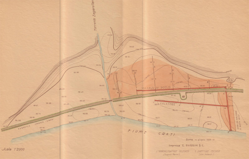
We have organized the historical information that we have collected in an historical archive kept at the headquarters of the Institute in Cosenza. The historical archive contains local history books and text, copies of archival collections of the State Archives, and copies of national and regional newspapers. Most of the documents wee obtained from the archives of public bodies, some of which are still unexplored. The documents contain descriptions of historical landslides and floods in Calabria, descriptions of the damage caused by landslides and flooding, and on countermeasures implemented to face the geo-hydrological hazards.
Our research on historical landslide and flood events is of scientific and applied interest. From a scientific point of view, we use data and information on historical landslides and floods, along with other data and information, to study the characteristics of the rainfall that can trigger landslides and cause flooding in Calabria, and what were their geographical and temporal variations.
From the application point of view, in addition to keeping alive the memory of events and sites damaged by past events, the analysis of historical data allows us to provide information on the damage caused to people, and to private and public properties. This information proves useful for the identification of areas exposed to the geo-hydrological risk, and for the design of future damage scenarios.
Donwload attachmentFurther details
Link to the Product “Historical ARchive of COsenza” in IRPI website »