
UAV FIXED WING CNR IRPI: aerial RGB and multispectral survey of Ponzano landslide

The CNR IRPI Geohazard Monitoring Group (GMG) on june of present year carried out an aerial multipurpose survey of an area interested by a landslide reactivation phenomenon over the village of Ponzano (center Italy – Abruzzo district).
The activitiy was performed using an RPAS fixed wing developed by the GMG equipped with an RGB mirrorless camera and a 5-band multispectral sensor.
The survey; 4,2 square kilometres big; demonstrates the potential of this aircraft, which allows the simultaneous mapping of RGB and multispectral areas affected by instability, making it possible to characterize areas with high humidity index not detectable with optical images.
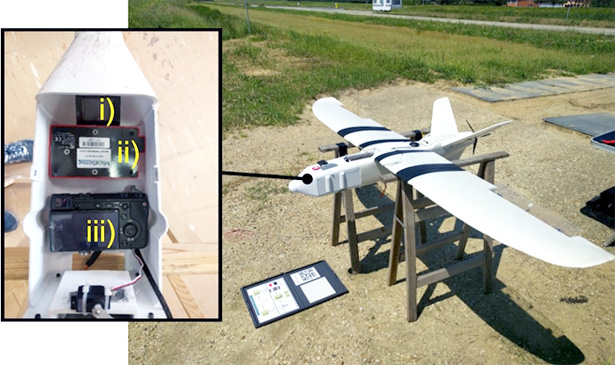
Figure 1: sensors bay and aircraft during multispectral calibration process.
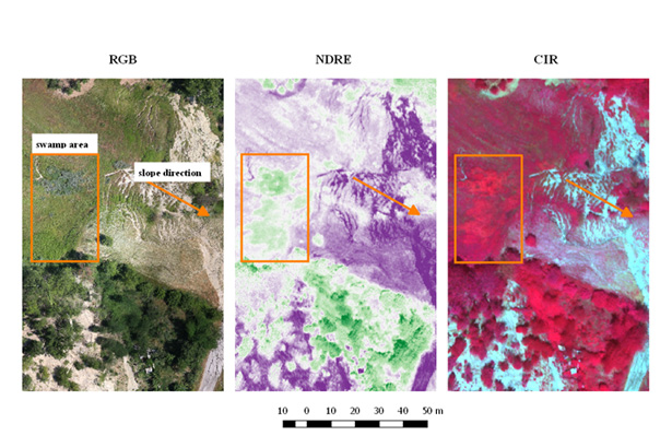
Figure 2: multiband image comparison of and area affected by an high humidity index.
For info:
Paolo.allasia@irpi.cnr.it
Marco.baldo@irpi.cnr.it
Danilo.godone@irpi.cnr.it


