
Integrated assessment of geo-hydrological instability phenomena in the Apulia region, interpretative models and definition of rainfall thresholds for landslide triggering
Project funded by P.O.R. PUGLIA 2014 – 2020, ASSE V – AZIONE 5.1 for an amount of 1.275.000,00 euro (GEO_PUGLIA)
Background
The Apulia region is affected by multiple types of geo-hydrological instability processes such as sinkholes, flash floods and landslides.
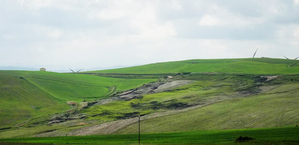
Landsliding mainly affects the north-western sector of the Region (bordering with Apennine chain) and the sea rocky cliffs.
The sub-Appennine Daunia portion of the Region is exposed to landslide risk due to hydro-geological setup of the soil/rock deposits, the poor mechanical properties of the lithotypes and the anthropic actions that can favour/trigger the triggering of landslides. The sea rocky cliffs are instead subjected to both the sea wave erosion and the progressive weathering of the rocks due to environmental factors that lead to the sudden collapses of entire cliff portions.
Another typical instability process in Puglia is represented by the sinkholes related to both the presence of natural karst caves and the diffuse existence of man-made caves excavated within soft rock formations, as the calcarenite ones.
The research project, which is the result of a joined cooperation between the Regional Civil Protection and the Research Institute for the Geo-Hydrological Protection of the Italian National Research Council, is aimed at providing advancements and insights in mapping of the instability phenomena, methodologies of risk assessment, definition of the triggering conditions as well as interpretation of the mechanisms of generation of the same phenomena within the regional territory.
Purpose
The project has the following general aims:
- assessing quantitatively the susceptibility of Apulia region to geological hazard events
- defining reliable risk scenarios, to be used for emergency planning and risk management.
In particular, the project provides:
- critical review of the data available from previous projects financed by the Apulia Region (WP1);
- collection and organization of a database related to the occurrence of geo-hydrological phenomena (WP2);
- update of rainfall thresholds for shallow landslides (WP3);
- implementation of a warning system for rainfall-induced landslide forecasting (SARF) (WP4);
- production of a landslide inventory map for the Daunia Apennine territory (WP5);
- landslide risk analysis for ten urban centers in the Daunia area (WP6);
- production of a database and a map of sinkholes and assessment of sinkhole susceptibility for the whole region (WP7);
- setup of a methodological approach for the assessment of coastal instability risk (WP8);
- numerical modelling of geo-hydrological phenomena (WP9);
- development of a decision support system (WP10);
- technical support to the Regional Civil Protection Department (WP11);
- monitoring activity of representative instability processes (WP12)
Products
The following project outputs were produced:
- WP0
- Relazioni di attività semestrali n.1, 2, 3
- Selezione dei casi studio per il WP12
- Selezione dei centri abitati per WP6
- WP1
- Analisi critica dei risultati derivanti da progetti precedenti finanziati dalla Regione Puglia
- Parametri e monitoraggio geotecnico
- WP2
- Progettazione e implementazione banca dati
- Progettazione e implementazione delle interfacce Web-Based e GIS per il popolamento e la consultazione della banca dati sui fenomeni geo-idrologici nella Regione Puglia
- WP3
- Analisi e importazione dell’informazione pluviometrica disponibile nella Regione Puglia
- WP4
- Regionalizzazione SANF
- WP5
- Metodologia per la realizzazione degli stereo-blocchi per l’interpretazione di immagini aeree stereoscopiche
- Criteri per la interpretazione delle frane da immagini aeree e satellitari
- WP6
- Relazione metodologica
- WP7
- Progettazione banca dati
- WP8
- Instabilità costiera nella Regione Puglia
- WP9
- Analisi ed interpretazione dei risultati di indagini in sito ed in laboratorio disponibili, nonché di dati di monitoraggio
- WP12
- Indicazioni preliminari per la progettazione dei sistemi di monitoraggio
 Internal contact person: piernicola lollino -